
Texas is staring down a rough winter weekend, and state officials are making one thing crystal clear: if people can stay off the roads, they should. A sprawling storm is lining up snow, sleet, and ice across much of the state, turning everyday commutes into risky bets and pushing emergency crews into full prep mode.
From Dallas and Austin to Houston and the smaller towns in between, transportation leaders and troopers are warning that icy bridges, freezing rain, and bitter wind chills will make driving dangerous, not just inconvenient. The message is blunt but practical: hunker down, reschedule plans, and let the storm pass before getting behind the wheel.
Texas braces for a large and severe winter storm
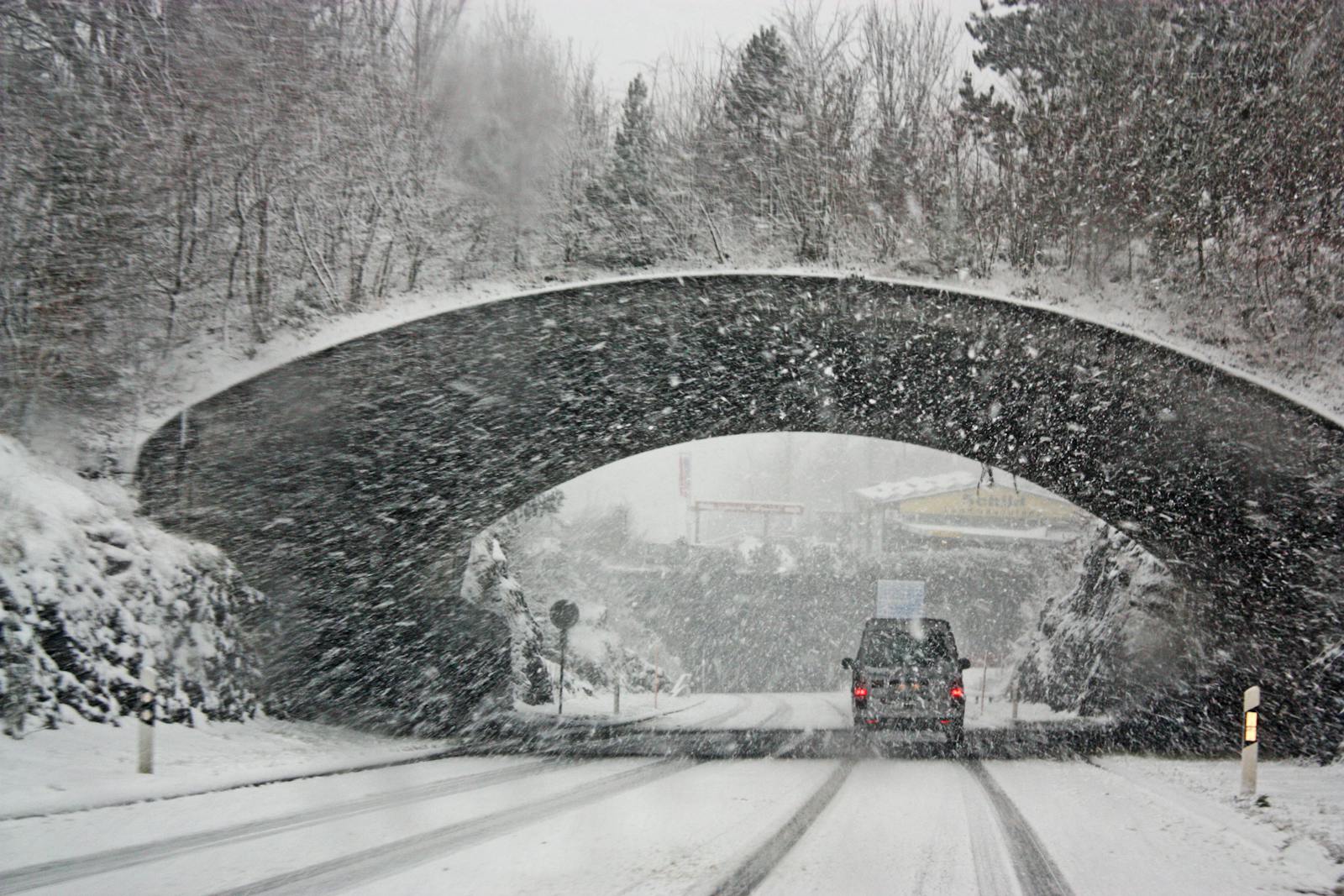
Forecasters are tracking a system big enough to touch nearly every corner of the state, with heavy snow, sleet, and freezing rain expected to stack up over the weekend. Much of Texas is under a winter storm warning as this large and severe Winter system pushes into cities like Austin, Dallas, and Waco, with meteorologist Natassia Paloma helping explain how a broad shield of moisture will collide with plunging temperatures to create a messy mix on the ground. In some areas, that means snow piling up, while in others it is more about a glaze of ice that can turn a routine drive into a slide.
What makes this setup especially tricky is how quickly conditions can flip from wet to frozen as the cold air deepens. Roads that look just damp at dinner time can be coated in black ice by the time people head home, a pattern already showing up in early reports from central and North Texas. With at least 48 hours of disruptive weather in play, officials are treating this as a statewide event rather than a local nuisance, and they are urging drivers to think in terms of the full storm window instead of just the moment they plan to leave the driveway, as outlined in the broad warning for Austin and Dallas.
Why officials are telling drivers to stay home
State transportation leaders are not sugarcoating their advice: they want people off the roads unless travel is absolutely necessary. The Texas Department of Transportation has laid out that with Winter weather expected to hit a large part of the state, bridges, overpasses, and elevated ramps are especially vulnerable to icing, which can happen even when main lanes still look passable. That is why TxDOT is directly asking drivers to stay home during the storm, framing it as a simple way to cut down on crashes, stranded vehicles, and gridlocked highways that slow down emergency response.
Law enforcement is echoing that message from the safety side. The Texas Department of Public Safety is mobilizing troopers to monitor highways and coordinate with the Texas Division of Emergency Management, but it is also telling people in plain language that the safest choice is to avoid driving at all. In BEAUMONT, Texas, officials have stressed that even experienced drivers can lose control when ice builds up, especially at highway speeds, and that staying off the road is the most reliable way to avoid spinouts and pileups. That combination of transportation and public safety guidance, from TxDOT and Texas Department of, is what is driving the unusually strong “just do not go” message this weekend.
North Texas roads already turning slick
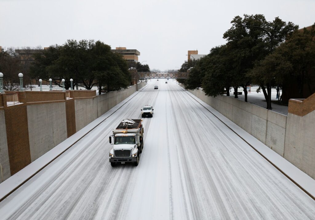
In North Texas, the storm is not just a forecast, it is already showing up on the pavement. Around Dallas and Fort Worth, roads are wet and getting more slick as temperatures drop, and the mix of ice and snow moves into the region. Drivers are seeing that familiar pattern where overpasses and flyovers freeze first, catching people off guard as they move from neighborhood streets onto high-speed connectors. Traffic maps are lighting up with slowdowns and minor crashes, a sign of how quickly conditions can deteriorate even before the worst of the storm arrives.
Transportation officials are urging anyone in the Dallas and Fort Worth area to treat every trip as optional unless it truly cannot wait. Real time traffic tools are showing trouble spots across the highway network, and the advice is to check conditions before even thinking about starting the car. For those who absolutely must travel, the guidance is to slow down, leave extra space, and assume that shaded stretches and ramps may be icy even if the main lanes look clear. The early slick spots highlighted on the North Texas map are a preview of what the rest of the weekend could look like if people keep driving as usual.
Houston and the Gulf Coast face ice and extreme cold
Farther south, Houston and the Gulf Coast are not escaping this one, even if they are more used to humidity than hard freezes. Houston will be under winter storm and extreme cold warnings starting Saturday night, according to the NWS, with Low temperatures around 20 degrees expected in parts of the metro area. That kind of cold is enough to freeze standing water on roads, burst exposed pipes, and strain power systems, especially in neighborhoods that are not built with repeated hard freezes in mind.
For drivers, the combination of freezing rain and those Low readings means elevated roads and coastal bridges could ice over quickly, even if surface streets stay mostly wet. Officials are urging people in Houston to plan to be home before the worst of the weather sets in on Saturday, and to avoid early morning drives when temperatures are at their lowest. The same advice extends along the Gulf Coast, where sea breezes can mask just how cold the air really is until a driver hits a slick patch on a bridge. The warning from Houston forecasters is clear: treat this like a serious winter event, not a novelty.
East Texas and local crews working ahead of the ice
In East Texas, city and county crews are trying to get ahead of the storm by treating roads before the worst of the freezing rain arrives. The Marshall Fire Department says they will be prepared to sand areas across the city, targeting hills, intersections, and other spots they consider dangerous once ice starts to form. That kind of pre treatment can make a real difference in the first hours of a storm, giving drivers a bit more traction and buying time for plows and additional sanding once precipitation ramps up.
Even with that work, local officials are not pretending they can make every road safe. They are emphasizing that sanding is a mitigation tool, not a magic fix, and that drivers should still avoid travel if they can. Rural stretches, shaded county roads, and smaller bridges may not see any treatment at all before they freeze. The message from East Texas leaders, including those coordinating with Marshall Fire Department, is that people should not let the sight of a sand truck lull them into thinking the roads are open for business as usual.
Statewide warnings from TxDOT and DPS
Across the state, transportation and safety agencies are lining up behind the same blunt warning: stay off the roads if at all possible. TxDOT has told Texans that as this Winter storm sets in, hazardous roads are likely across a wide area, and that staying home is the single most effective way to reduce crashes and keep emergency routes clear. The agency is activating its winter weather plan, which includes pretreating major corridors, staging equipment, and coordinating with local partners, but it is also reminding people that no amount of preparation can fully overcome a sheet of ice on a busy freeway.
Public safety officials are backing that up with their own outreach. In Southeast Texas, the Department of Public Safety is using social media to remind drivers to slow down, increase following distance, and avoid using cruise control in poor conditions, since that feature can keep a car accelerating when traction suddenly disappears. The short video clips aimed at Southeast Texas residents are part of a broader push to get the word out before the worst of the weather hits, and they reinforce the idea that the safest speed on an icy road is often zero. Together, the alerts from TxDOT and the reminders from the Department of Public are meant to reach everyone from daily commuters to weekend travelers.
Hospitals, patients, and essential travel only
While most people are being told to stay put, some trips cannot wait, and hospitals are planning around that reality. A Winter Weather Advisory Communications notice from Odessa Regional Medical Center explains that The National Weather Service has issued a winter storm warning for the area and that patients should pay close attention to appointment updates and call ahead if they are unsure about travel. The hospital is balancing the need to keep critical care running with the risk of having patients and staff out on icy roads, and it is encouraging people to reschedule non urgent visits when possible.
For those who truly must be on the road, whether for medical reasons, shift work, or emergency response, the advice is to treat every mile like a potential hazard. That means leaving early, driving slowly, and packing basics like blankets, water, and a phone charger in case a short trip turns into a long wait. Health care facilities are also reminding families that emergency rooms will remain open, but that calling ahead or using nurse hotlines can help determine whether a drive is necessary in the middle of a storm. The detailed guidance in the Winter Weather Advisory is a good snapshot of how essential services are trying to keep people safe without cutting off care.
How to track road conditions before you leave
For anyone still tempted to venture out, checking road conditions is non negotiable. Texans can track real time highway conditions and closures online, using tools that show where ice, crashes, and construction are already causing problems. One statewide resource lets drivers see color coded maps of traffic speeds and incident reports, which can quickly reveal that a route that looks fine on a basic navigation app is actually crawling because of ice. These tools are especially useful during a Winter storm when conditions can change block by block and hour by hour.
Officials are also pointing drivers toward state maintained platforms that focus specifically on safety and closures rather than just travel time. A key example is the interactive map at DriveTexas, which compiles information from across the highway system and highlights trouble spots. Another guide on how Texans track conditions emphasizes that bridges and overpasses can become hazardous long before surface streets, and that drivers should pay special attention to those segments on any map. The bottom line is simple: if the tools show widespread ice and slowdowns, the safest choice is to close the laptop and stay home.
Timing, hotspots, and what the weekend could look like
Timing matters with a storm like this, and officials are trying to give people a clear sense of when roads will be at their worst. Forecasts indicate that some of the heaviest impacts will hit overnight and into the early morning hours, when temperatures are lowest and crews have the toughest time keeping up with refreezing. In North Texas, a Winter Storm Warning is in effect, and areas to avoid driving in this weekend include major interstates, elevated connectors, and known trouble spots that tend to ice over quickly. Leaders at TxDOT say their Winter weather plan is already underway, but they are warning that even treated roads can become slick if precipitation keeps falling and temperatures stay below freezing.
More from Wilder Media Group: