
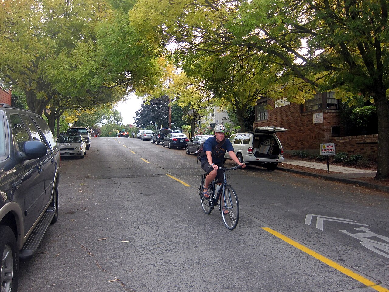
You step onto a street where painted green lanes quietly change who feels welcome on the road. Cities are rolling out green pavement and protected bike paths to make cycling clearer, safer, and more predictable for everyone sharing the road. These green lane systems reduce conflicts between cyclists and motorists by increasing visibility and defining dedicated space, directly improving safety and traffic flow.
They show up on major corridors and neighborhood streets alike, using color-enhanced markings and physical separation to guide movement and calm vehicle speeds. Expect the article to explore how these design choices work, practical examples from cities, and what the changes mean for daily trips and local traffic patterns.
Green Lane Systems: How They Enhance Cyclist Safety and Traffic Flow
Green lane systems combine colored pavement, physical separation, and clearer rules to make cycling safer and traffic more predictable. They increase cyclist visibility, reduce motor-vehicle encroachments, and channel movement so motorists and cyclists can anticipate each other’s paths.
What Are Green Lane Systems?
Green lane systems are dedicated bicycle lanes that use colored pavement and design treatments to signal priority and function. They can be one-way or two-way and are sited between sidewalks and travel lanes or between parking and travel lanes, depending on the street cross-section.
Design elements include green pavement markings through conflict zones, continuous lane coloring at intersections, and standard bike-lane widths (typically 1.5–2.5 m / 5–8 ft). Municipalities often pair these with signage, bike signals, and curb ramps to integrate with transit and pedestrian networks. The goal: make bicycle space legible, continuous, and safe for riders of varying skill levels.
The Role of Green Pavement Markings in Visibility
Green pavement markings increase conspicuity where motorists and cyclists interact, such as near driveways and turn lanes. Bright green paint highlights the intended path for cyclists and signals motorists to yield or merge, lowering the chance of side-swipe and right-hook collisions.
Evidence shows solid green markings across potential conflict points raise driver awareness and reduce encroachments. Cities commonly use thermoplastic or epoxy paints with reflective aggregates for durability and nighttime visibility. Well-placed green markings guide behavior at intersections and boarding zones, making lane boundaries and cyclist presence visually unambiguous.
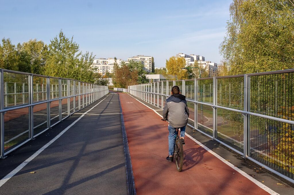
Physical Separation and Protected Bike Lanes
Physical separation creates a barrier—curbs, planters, parked cars, or flexible posts—that prevents motor vehicles from entering bike space. Protected bike lanes, also called cycle tracks, place cyclists in their own cross-section, often between the curb and a row of parked cars or a raised curb.
Separation reduces collisions from lateral encroachment and offers predictable alignment for cyclists and drivers. Typical separation types: vertical curb, bollards, buffer zone with flexible posts, and continuous raised platforms. Each option has trade-offs for drainage, snow removal, and curb access, so cities select treatments based on street width and maintenance capacity.
Reducing Conflicts and Improving Predictability
Green lanes reduce conflict points by clarifying who goes where and when, especially at intersections and driveways. Continuous lane markings and separated alignments funnel cyclists through consistent paths, which lowers unexpected maneuvers and improves sightlines for turning drivers.
Traffic flow benefits because drivers no longer need to guess cyclist position; they can merge earlier or adjust speed with confidence. Where jurisdictions have used bike signals and extended green surfacing, they report smoother vehicle turning movements and fewer abrupt lane changes. Clear rules and visible lanes make both cycling and driving behavior more predictable.
Design Strategies and Broader Impacts of Green Bike Infrastructure
Green bike infrastructure uses physical separation, reduced motor lanes, and smart intersection treatments to improve rider safety, lower vehicle speeds, and expand access to active transportation across dense corridors.
Key Elements: Delineator Posts, Planters, and Road Diets
Flexible delineator posts provide low-cost, visible separation between cyclists and motor traffic. They are quick to install, reduce lateral encroachment, and act as visual cues that narrow travel lanes; agencies often place them at 10–15 ft spacing depending on speed and curb geometry. Planters add mass and greenery, creating a stronger physical barrier and stormwater benefits when sized to lane width and mounted on concrete pads to prevent displacement.
Road diets—typically converting four lanes to three (two travel lanes plus a center turn lane)—reduce motor vehicle volumes and speeds, free up space for protected lanes, and cut conflict points at driveways. Cities pairing road diets with delineators and planters report clearer lane allocation and improved cyclist comfort on busy arterials.
Cycle Tracks, Separated Bicycle Lanes, and Intersection Design
Cycle tracks and separated bicycle lanes use vertical or raised elements to offer continuous protection and prioritize bicyclist space. Designs vary from curb-separated one-way tracks to two-way protected lanes; alignment decisions should follow corridor speed, parking demands, and adjacent land use. Compliance with design guidance—such as the updated NACTO Urban Bikeway Design Guide—helps match geometry to expected rider types.
Intersections require special treatments: left-turn refuge islands, dedicated bike signal phases, and curb extensions can reduce conflict points. Marked crossbike crossings and leading bicycle intervals lower turning collisions. Engineers should consult crash modification factors when evaluating treatments, since signal timing and physical separation yield measurable crash reductions when applied together.
Health, Environmental, and Mobility Benefits
Protected bike infrastructure increases ridership by making streets feel safer, which expands active transportation options for older adults and inexperienced riders. Increased cycling contributes to public health through higher physical activity and lower rates of cardiorespiratory disease when travel shifts from cars to bikes.
Green lanes also improve air quality by reducing vehicle idling and encouraging mode shift; planting elements enhance local pollutant capture and urban cooling. From a mobility perspective, reallocating lane space can improve person-throughput on busy corridors, especially when paired with traffic-calming measures that manage motor vehicle volumes and congestion.
Implementation Challenges and Future Directions
Placing protected lanes often meets institutional and political hurdles: parking loss, transit interactions, and emergency vehicle access require tailored mitigations. Agencies must integrate guidance from the Manual on Uniform Traffic Control Devices and adopt a safe system approach to set realistic design standards and liability expectations.
Maintenance of delineator posts, planters, and pavement markings is crucial; a documented maintenance plan reduces deterioration and preserves crash reduction benefits. Future directions include scalable pop-up pilot projects, using performance data and community outreach to justify permanent upgrades and to expand a connected bike network that closes key gaps in urban mobility.
More from Steel Horse Rides: